The Teesta Valley
An important branch of the D.H. Railway system leaves the main line just outside Siliguri railway station, and after crossing a belt of the Terai at the foot of the Himalaya runs up the valley of the River Teesta.
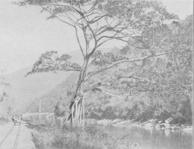
The Teesta River near Sevoke (note the railway trolley)
The great River Teesta, like many other drainers of the Himalayas, rises on the northern side of the high mountainous tract. It then flows southwards through Sikkim, receives tributaries from the great snowy peaks, and cuts its way through the mountain barrier to the plains, where it eventually joins the Brahinaputra River and empties its waters into the Bay of Bengal. It is the principal river of Sikkiin and, indeed the main drainer of the lofty snowy peaks of the Kinchenjunga group, and it forms the boundary between Sikkim and British India for many miles. But before leaving the Himalayan tract it receives that other great drainer of the snows, the great Rungeet River, and, enlarged by the waters of this river, flow. for nearly twenty miles in a deep narrow valley between lofty forest-clad mountains before it debouches on the plains at the gorge known as, the Sevoke Pass. It is up this deep valley, for 16 miles, that the Teesta Valley Extension of the D.H. Railway follows every bend of the river and affords a magnificent succession of beautiful views.
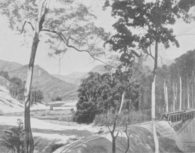
Teesta River and Railway - Mile 18
The Teesta Valley line was opened for traffic in the year 1915. It has been constructed largely on or near the alignment of the old Public Works Department road, which was abandoned by Government some years previously in the following circumstances. In the year 1899; there was, an unprecedented rainfall in the Eastern Himalayas. Disastrous landslips occurred in many places, and rivers rose 30 ft. to: 50 ft. in a night. The Teesta came down in a flood of great height, overflowed its banks and caused great damage; large stretches of forest were swept away and long portions of the Teesta Valley Road practically disappeared. In consequence of this a new road at a higher level was built in 1907 and 1908 and some years later the railway company took over the old road and used it as a basis for a railway track up the valley from Sevoke to Kalimpong Road, to tap the resources of Sikkim and of Tibet through the trading centre of Kalimpong.
Travellers to Darjeeling who can spare the time will be amply repaid for undertaking the railway trip up the Teesta Valley by the magnificent scenery they will enjoy, whether they intend to continue the journey up the hill to Kalimpong and visit that place or whether they return again to Siliguri by the evening train from Kalimpong Road railway station. It is not possible for the traveller to do the trip up the river valley and return to Darjeeling on the same day; he must make arrangements to spend the nights preceding and following the trip at the Dak Bungalow (Travellers' House) at Siliguri. Accommodation in this Bungalow can be reserved on application to the Superintending Engineer, Darjeeling, and Messrs. Sorabjee, Railway Refreshment Room, Siliguri, will arrange for supply of all meals, etc.
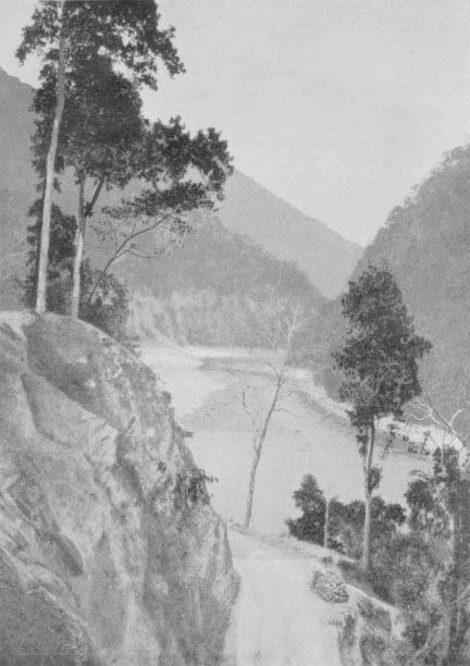
River Teesta
For the first twelve miles from Siliguri the Teesta Valley Railway crosses the Terai, a tract of almost level country lying at the base of the Himalayan ranges. The railway track is here laid beside a broad cart road, and is soon fringed by a sal tree forest which provides cover for tigers and wild elephants. Then the Sevoke River is crossed by a fine bridge just above its Junction with the Teesta and the valley of the Teesta itself, here 750 yards wide, is suddenly entered at the point where the great river has cut its way from the mountainous tract to the plains through a deep and narrow gorge. At once on passing through the Sevoke gorge, the traveller finds himself enclosed by steep mountains with the great river flowing close at land. The mountains are clothed in dense forest, and during the months of the cold weather season (November to February), when the waters of the river are jade-green, and when white rocks appear between the dark overhanging foliage above and the deep green river below, the colour and grandeur of the scene are startlingly impressive. During the rainy season the waters are not so beautiful in colour, bearing at this season a milky hue, but the volume is of course greater and the current is then seen to be very swift, running in places at the rate of 14 miles an hour.
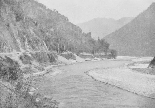
Kalijhora, Teesta Valley
Threading its way along the steep sides of the narrow valley the track now circles round deep wooded bays in the depths of which torrents rush down to the river below, now passes through shady groves of overhanging forest trees, and now circumvents precipitous rocks, the great river itself being ever present but a hundred feet or less below. Sweeping round a bend the line then reaches Kalijhora (the black stream). Here a bridge spans the mountain torrent which has given its name to the spot. After Kalijhora the valley is somewhat less confined and higher mountains become open to view beyond arid above the forest clad slopes that enclose the river, until as the track approaches Riyang, a view of the snowy range itself is obtained.
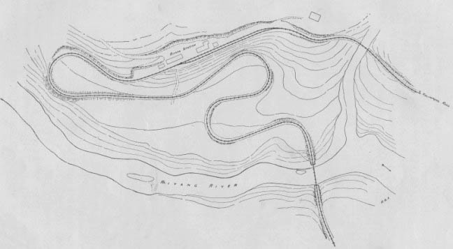
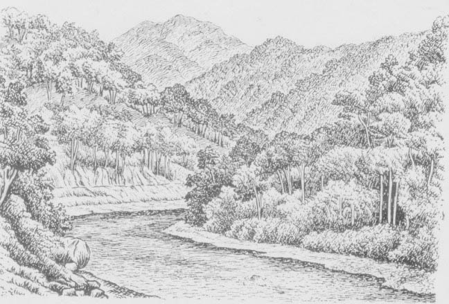
Diagram of the river at Riyang
The approach to Riyang Station is an interesting engineering feat, the quick rise from bridge over the river to the level of the station being obtained by a double eight curve. The river scenery here, and just after the station is left, is exceptionally lovely. Bold mountains rear their lofty summits high above the swift waters of the river which here flows around beautiful bends and has thrown up banks of pure white sand and glistening pebbles at each turn.
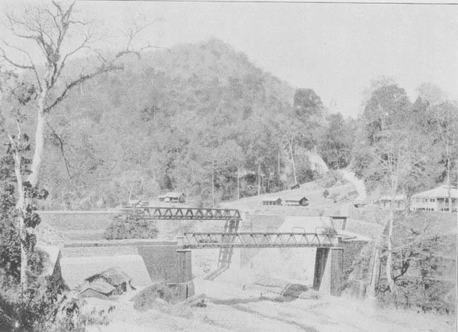
Below Ryang Station
The River Riyang which is crossed here came down in mighty flood some years ago, and changed its course decisively within the space of a single night. The piers of the old bridge, marking the original course of the river, may be seen standing high and dry in a wilderness of stones.
Shortly after Riyang is left the track passes for half a mile through tropical forest and then, emerging again from the trees, it appears to almost overhang the river flowing swiftly below. Borne along now at a height of over a hundred feet above the waters of the Teesta, the traveller obtains, magnificent views up and downstream, with the great mountains of Sikkim looming on the northern horizon. As the track approaches Kalimpong Road Station the most difficult part of the line from an engineering point of view is reached. Here much heavy blasting had to be done and intermingled with the shaley nature of the mountain sides caused much trouble. But the scenery grows always more grand with its succession of lovely gorges and the traveller by the time he reaches the terminus of the little railway line near the Teesta Bridge, will have enjoyed a countless number of views presenting the wildest and most picturesque associations of mountain, river, and forest conceivable.
The River Teesta at Mile 28
A good road continues from Kalimpong Road Station to the Teesta Suspension Bridge, and if lie is not pressed for time the traveller is advised to walk the two miles. The bridge is an elegant structure suspended high above the river which thunders down the gorge a hundred feet below. All along the bridge itself, and stretched across the river between the flanking towers of either extremity, will be seen streamers and flags, offerings of Tibetan passengers to the spirits of the torrent.
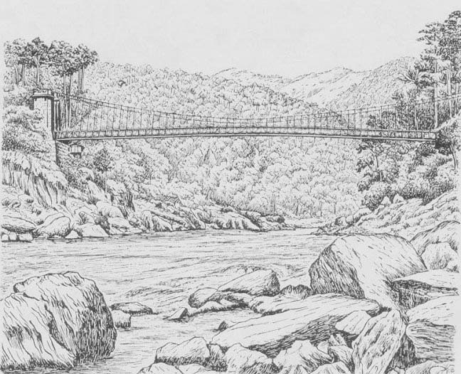
Teesta Suspension Bridge
Kalimpong is distant seven and a half miles up the mountain from the Teesta Bridge and a description of the route to this hill station from the Teesta will be found in the next chapter.