Close to Darjeeling are the Cantonments of Lebong, Jalapahar and Jalapahar. The former lies north of Darjeeling and the two latter are situated south of the town on the crest of the ridge above Ghum. Ghum is principally important to the traveller in its relation to Senchal Mountain. Fifteen miles, further south and built on a spur overlooking the beautiful valley of the Balasun River is the small but growing hill station of Kurseong. It is to information about these places that the present chapter will be devoted.
Lebong Cantonment stands on a lesser spur running from the northern end of the main Darjeeling Ridge and has an elevation of 5,970 feet. There are two routes from Darjeeling to Lebong, one (about 2 miles) being from the Chowrasta by the Rungeet Road to the east of the Mall, and the other (about 5 miles) via the Cart Road front the Railway Station and the Municipal Market. The former route which passes through the Bhutia Basti is steep but rickshaws can be used. The route by the Cart Road, a gradual descent, is very beautiful both by reason of the ravines and valleys of the locality and on account of the excellent views obtained of the snowy range. The Cantonment can also be reached through the Birch Hill Road.
Lebong is well seen from the Mall, east of Government House gate. It has accommodation for a battalion of British infantry, a Parade ground, and a church. It is about 10 degrees warmer than Darjeeling. On the slopes of the spur below and beyond the Cantonment are several tea gardens.
At the Lebong Parade Ground the Darjeeling races and station polo are held at suitable seasons of the year.
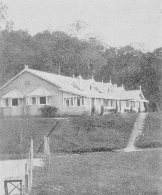
Jalapahar is the name of the hill above Darjeeling, which forms part of the ridge running from Ghum down to Lebong.It is a convalescent depot to which invalid soldiers are sent from the plains, of Bengal and there are barracks, officers quarters, a military hospital, church and parade ground.
Jalapahar is. best reached through the Auckland Road (about 2 miles from the Chowrasta via Commercial Row). Rickshaws may be used for the ascent, about 500 feet. There is another route from the Chowrasta via the Jalapahar Road. This road passes St. Paul's School which is one of the two principal boys' schools in the Eastern Himalaya. It was founded in Calcutta in 1846 and removed to Darjeeling in 1864. ,There are nearly two hundred boys in the school. The playing grounds include nearly 40 acres and very fine views of the snows and of the Darjeeling and neighbouring spurs are obtained from the school site.
Above Jalapahar, on the summit of the ridge, is Jalapahar. Here is a small cantonment where about 200 men and officers of the artillery are stationed. A good road descends from Jalapahar and Jalapahar to Ghum, whence the return to Darjeeling may be made either by rail or via the Auckland or Cart Road.
Ghum will be remembered by the traveller as the highest point to which the railway attains (7,407 feet). It is a place of some importance as a trade centre, standing at the junction of the three principal roads of the locality : the Cart Road from the plains, the road to the Nepal frontier, and the road to the Teesta Valley, Kalimpong; and Tibet. There are two hotels at Ghum :the Pines and the Balaclava Hotel, both of which cater for lunch and tea for tourists. The traveller to Darjeeling should not omit Ghum, and especially the ascent of Senchal Mountain, from his programme if he can spare a day.
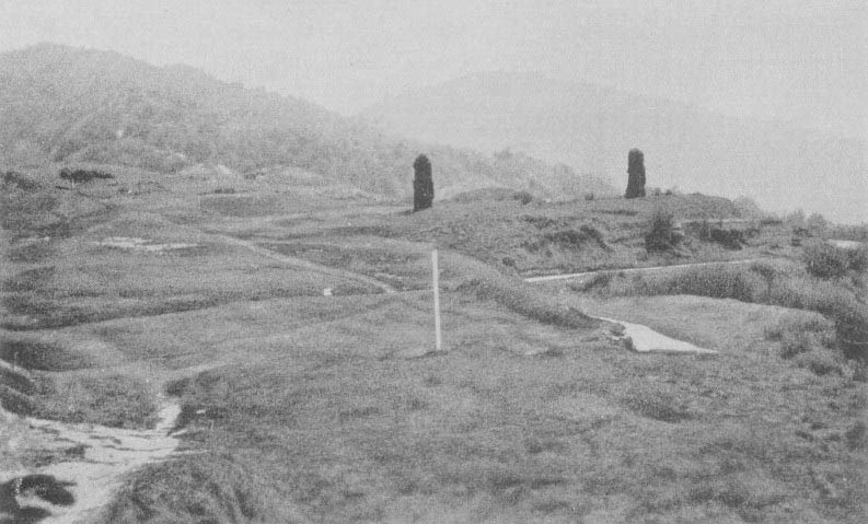
Golf Links at Senchal
A good road ascends Senchal for two miles from the eastern end of Ghum Bazaar. The ascent of the mountain is fairly steep but ponies are easily obtained at Ghum and a dandy or rickshaw may be engaged by previous arrangement from Darjeeling. The road ascends through a thick forest of oak, maple, birch, chestnut, laurels., magnolias and rhododendrons, the two latter, when in bloom in April and May, affording a magnificent blaze of colour. Many varieties of ferns clothe the banks and rocks on either side of the path, while the trunks and branches of the trees are hung with lichens, mosses, and orchids., At one time there were in Military barracks on the summit of Senchal (8,163 feet) but these were abandoned some years ago in favour of Jalapahar, and the open grassy slopes which are a pleasant feature of the top of the mountain have been laid out in Golf Links.
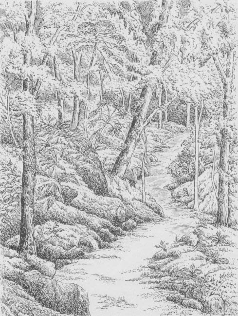
A path in the forest
A mile above Senchal the road tops Tiger Hill (8,515 feet). The views from Senchal and Tiger Hill are the finest obtainable in the immediate neighbourhood of Darjeeling. To the .south beyond the Kurseong Spur, the plains of India. threaded by the courses of four great rivers, the Teesta, Balasun, Mahanaddi and Mechi, lie stretched out as in a map. To the north immediately below Senchal is the deep valley of the Rangeet River, 7,000 feet below, which runs into the valley of the great Teesta beyond which are seen range upon range of the mountains of Sikkim, Nepal and Bhutan topped by a great line of snowy peaks along more than half the horizon. The great Kinchenjunga with its twin peaks forms the centre of the snowy mass, the summits of Kabru and Jannu standing on the western side and those of Pandini and Nursing on the east, all within 45 miles distance from Senchal. Chumularhi Mountain, of Tibet, is seen in the north east, 84 miles away, appearing as a great rounded mass over the snowy Chola Range. But the peak that claims the chief interest is that of Mount Everest (28,002 feet) which is seen above the black Singalela Range to the north west over 100 miles distant. Only the top of Everest is seen, standing between two other peaks one of which, the arm chair shaped Makalu (17,799 feet), makes a loftier appearance than Everest on the horizon as it is considerably nearer.
Tiffin baskets, drinks, etc., to be taken up to Senchal, call be obtained by arrangement from hotels at Ghum or Darjeeling, and coolies are available. Using the train for the journey to and front Ghum the visitor call make the trip up Senchal and readily return to Darjeeling the same day. But there is a comfortably furnished bungalow on the top of the mountain and leave for use of this can be obtained from the office of the Deputy Commissioner, Darjeeling. A favourite plan is to ascend Senchal in the afternoon or evening to spend the night at the bungalow, and rise early to see the sunrise effects on Everest and Kinchenjunga.
Senchal is unfortunately very frequently shrouded in mist, the spur on which it forms a prominent summit intercepting the full force of rain clouds from the Bay of Bengal. But although the visitor may be disappointed of his hopes of obtaining distant views he will find the forest through which the path ascends, and the grassy slopes on the top of the mountain, well worth the excursion on their own account. There is, moreover, a Buddhist Monastery at Ghum which may be visited if local weather conditions do not invite the ascent of Senchal.
Four miles from Ghum, along the road that leads from the railway station westwards to the Nepal frontier, is the Ghum Rock, a favourite spot for picnic parties. This rock forms one of the natural curiosities of the locality; it is a large boulder of gneiss, 100 feet high, and from its flat top fine views are obtained of the Balasun Valley, the Nepal range, and the plains. It is said that previous to British rule criminals were executed by being thrown from this rock.
Three miles from Ghum in the opposite direction and approached by a broad cart road running eastwards from the middle of the bazaar is the Rangaroon Botanic Garden. This garden is the father of the Darjeeling Botanic Garden and was abandoned in favour of the latter as the site at Rangaroon was rendered unsuitable by violent hail storms. The broad road from Ghum Is almost level for two miles, then there is a drop for a mile by a path on the left through thick forest to the Rangaroon .bungalow. A good view is obtained from the bungalow across a deep valley to the snowy range and the forest scenery here is the finest around Darjeeling.
Thirty two miles from Siliguri and nineteen from Darjeeling and on a lower spur of the Senchal-Singalela Range stands the hill station of Kurseong at an elevation of 5,000 feet. This town enjoys a milder climate but a larger rainfall than Darjeeling, is situated in a delightful position above the Balasun Valley, and is giving promise of developing into a flourishing hill station, not rivalling but complimentary to Darjeeling. The view of the snowy peaks from Kurseong is limited to an appearance of the summits of Kinchenjunga, Kabru, and Jannu above the saddle of the Ghum Range where it dips west of Senchal, but although inextensive the view is very fine and is rendered especially picturesque and effective by the dark hue of the forest clad range immediately below the snowy horizon. The Balasun Valley aforementioned lies directly below Kurseong the whole length of the ridge on its western side, and is bounded by the Nagri and Mirik Spurs that enclose the subsidiary valley of the Rangbong, the whole presenting a magnificent outlook over deep valleys and over hills studded with the shining white buildings of tea factories. To the south is a totally different view. From Eagle's Crag and from the Punkhabari Road a wonderful view over the plains is obtained, more extensive than the view of the plains, front Senchal and more impressive from the fact of the Kurseong Spur itself dropping abruptly to the plains immediately below, and from the view of spur after spur of blue ranges in the west, jutting out into the plains one behind the other till lost to view in the blue distance.
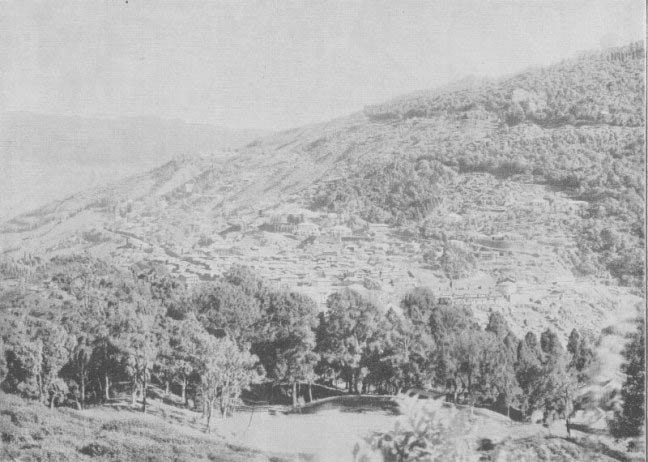
Kurseong from Eagle's Crag
The history of Kurseong is bound up with that of Darjeeling, the spur on which it stands having been included in the tract of country leased and finally annexed from Sikkim.
The principal roads at present are the Punkhabari Road, which ascends to Kurseong from the plains at its western extremity, and runs up the ridge to the railway station: the Cart road, which runs beyond the railway station through the bazaar and past residential quarters and the Clarendon Hotel at the northern end of the station; and the Dow Hill Road, which ascends from the railway station up the track of an old military road (built by Lord Napier of Magdela when a young officer) to the summit of the ridge.
On the Punkhabari Road stand "Constantia " (the Subdivisional Magistrate's, house), the Parsonage, Springside Tea Factory, Woodhill Hotel, the Church, the Kacheri, the Amusement Club, the Railway Offices,, and lastly close to the railway station the Post Office.
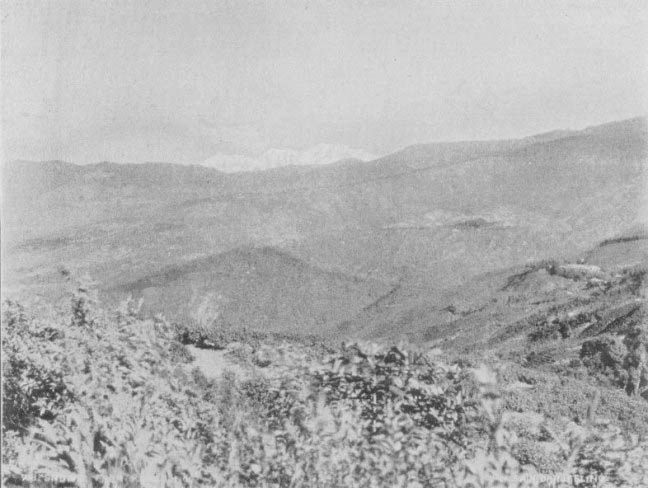
The snows from Kurseong
Near the railway station are the principal shops, chemists and stores. After emerging from the bazaar the Cart Road passes above the houses of the Monteviot Estate which together with the hotels provide the principal accommodation for visitors to Kurseong. Above the Cart Road are the houses of the General Manager and other officers of the D.H. Railway, the Roman Catholic Church, the St. Helen's Convent School and the Clarendon Hotel (1 mile from railway station).
The Dow Hill Road leads up to Victoria School and Dow Hill School which are large Government institutions for the education of boys and girls, principally children of railway employees and Government servants generally.
The Amusement Club has four tennis courts, a ball room, bridge rooms, library, etc. There is an arrangement by which visitors can become temporary members at a small charge. Ladies. also can become members.
The Kurseong Club
The visitor to Darjeeling should endeavour to devote a day or two to Kurseong. He will find convenient trains between the two stations. Meals and tiffin baskets can be, obtained at short notice from the Railway Refreshment Room.
There are several pretty and interesting short walks, about Kurseong, notes, of which will now be given, taking the railway station as the starting point
1. Take the road branching off from the Cart Road immediately east of the railway station. It is one mile's fairly easy ascent the summit of the Hill known as Eagle’s Crag, where very fine views are obtained over the plains and to the snows.
Follow the road for a quarter of a mile, then take the narrower road on the left. This road circles Eagle's Crag, is almost level, and commands excellent views across numerous spurs of mountains. After a mile and a half the road joins the Punkhabari Road by which on turning to the right a return to the railway station may be made past the Church and Club (3 miles in all).
2. Follow the Cart Road up through the bazaar for half a mile. Take a turning on the left, the Monteviot Road. Follow this. road for half a mile and then turn to the left again into the Bourdillon Road. The road commands beautiful views of the Balasun River and Valley and of the Mirik and Nagri Spurs. The Punkhabari Road is met south of the Club. Turn to the left and return to railway station past the club and railway offices (2 miles, in all).
3. Take the Dow Hill Road up the hill opposite the railway station. A fairly stiff climb for one thousand feet affords very extensive views. Ponies and dandies are available at the railway station. Pass below Dow Hill School (2 miles) and continue the ascent. The road soon crosses to the eastern side of the ridge and affords very varied views. “The Chimneys" are merely the ruins of an old staging bungalow on this, the original route to Darjeeling from the plains, but the hill side here is open with grassy slopes, and the forest and views are very fine. On the return, half a mile below Dow Hill School, vary the walk by taking the turning on the right and descend to the Cart Road near the Clarendon Hotel by Weston Road.
4. A delightful climb through a forest of cryptomerias to Victoria School, where good views are obtained, is got by turning to the right a mile and a half above the railway station. The walk may be continued to Dow Hill and "The Chimneys" from Victoria School.
5. Follow the Cart Road down from the railway station for a mile and a half where it runs out on a promontory. Here is a summer house commanding magnificent views of the Terai, the plains, and countless ranges of mountains running down to the plains. The scene is best at sunset.